Today

Innovate! Inc.

IT/GIS Manager

  • Manages and supports personal and professional development of a team of GIS analysts, technicians, and developers
  • Acts as Program Manager for US EPA Region 9 contract ($2m+/yr), GDIT-MAINES ($400k+/yr) support to the EPA National Geospatial Support Team, and SWERI ReShape ($800k+/yr)
  • Continues to manage and advise design, development, and maintenance of geospatial applications, with a focus on long-term strategic planning and program management
  • Continues to participates in communities of practice and relationship building with clients whenever possible

2016 Mar

Innovate! Inc.

GIS Analyst/Developer

  • Completed, managed and advised 100+ GIS projects annually for environmental applications, including scoping, planning, execution, testing, and training to ensure scientific integrity for client- and public-facing deliverables
  • Participated in EPA GIS communities of practice to build relationships across regions and offices, including presenting innovative and collaborative projects in the annual agency-wide EPA GIS Workshop (conference)
  • Assisted in design, development, and maintenance of geospatial applications through concept, design, and implementation, including Agile implementations largely using the GitHub version control system

2015 Nov

NC Sea Grant

GIS Analyst

  • Conducted data inventory for watershed restoration projects on the North Carolina coast with a focus on identifying current and potential oyster restoration sites
  • Created a series of multimedia maps to establish a local school curriculum on shellfish/sustainability and to better inform local decision makers about environmental and economic benefits of aquaculture

2015 June

NASA DEVELOP

Intern

  • Collaborated on interdisciplinary feasibility projects to address environmental and public policy issues
  • Used NASA Earth Observations Systems and NOAA Climate Data Records to assess the spatio-temporal relationship between post-burnout flooding and vegetation regrowth in the Southwest US
  • Developed end products to assist project partners in future decision making after wildfire burnouts

2014 Aug

Center for Geospatial Analytics, NCSU

Teaching Assistant

  • Facilitated weekly lessons for three graduate level courses, including communicating expectations, producing and monitoring help forums in person and virtually, and grading assignments
  • Collaborated with an instructional team to update and improve course materials

2012 May

Wildwater Ltd

Canopy Ranger

  • Provided natural and historical interpretive information and technical instruction on zipline and canopy tours while maintaining the safety of groups of 10-12 people
  • Hosted overnight camping retreats along the Wild and Scenic Chattooga River
  • Facilitated weekly catered meals for 300 people

Things

EPA Region 9 Data Management Tool

Data Management Tool (DMT)

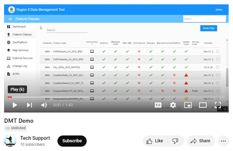
Served as a principal developer and ScrumMaster for the DMT (demo Here), winner of Esri’s 2018 Federal Small Business Specialty Innovation Award, in response to Region’s 9’s need for up-to-date and accurate geospatial data. The application serves as a single point of entry to find resources and identify their location, accuracy, and relevance.

EPA Account Request Tool

Account Request Tool

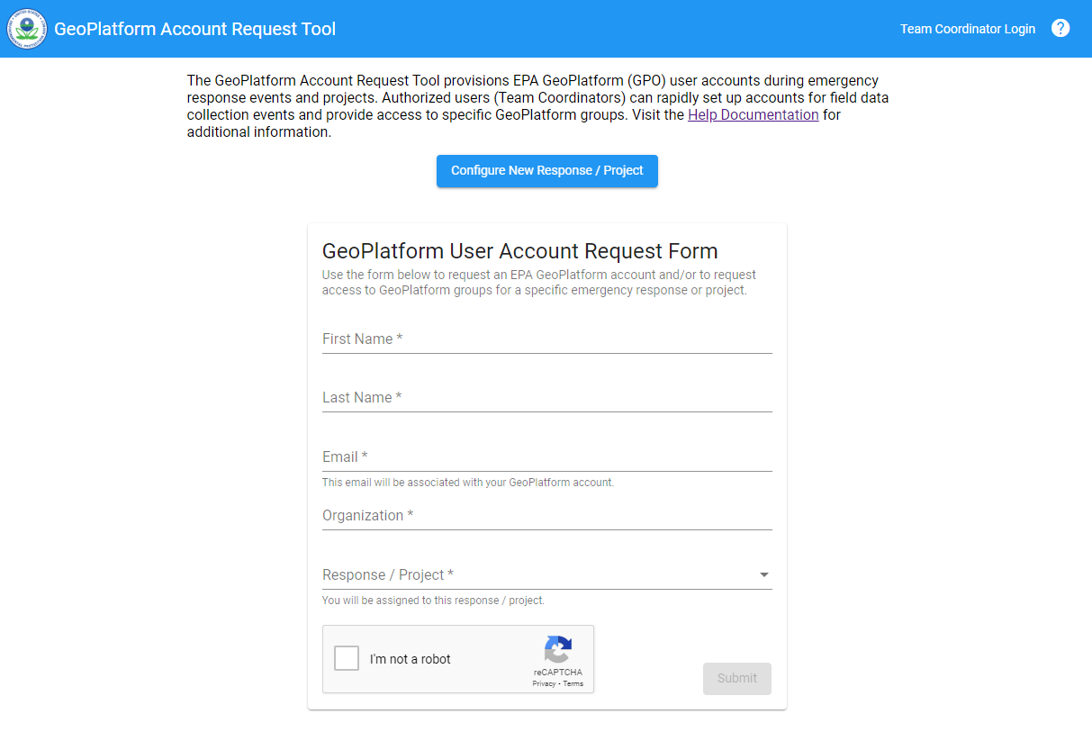
The ArcGIS Online Account Request Tool is a web-based tool to rapidly provision external user accounts to an ArcGIS Online Organization. It provides transparency during mass requests, easy access request tracking, and mitigates duplicative accounts. The tool is the single most widely used account tool at EPA.

SWERI's ReSHAPE TWIG Viewer

ReSHAPE TWIG Viewer

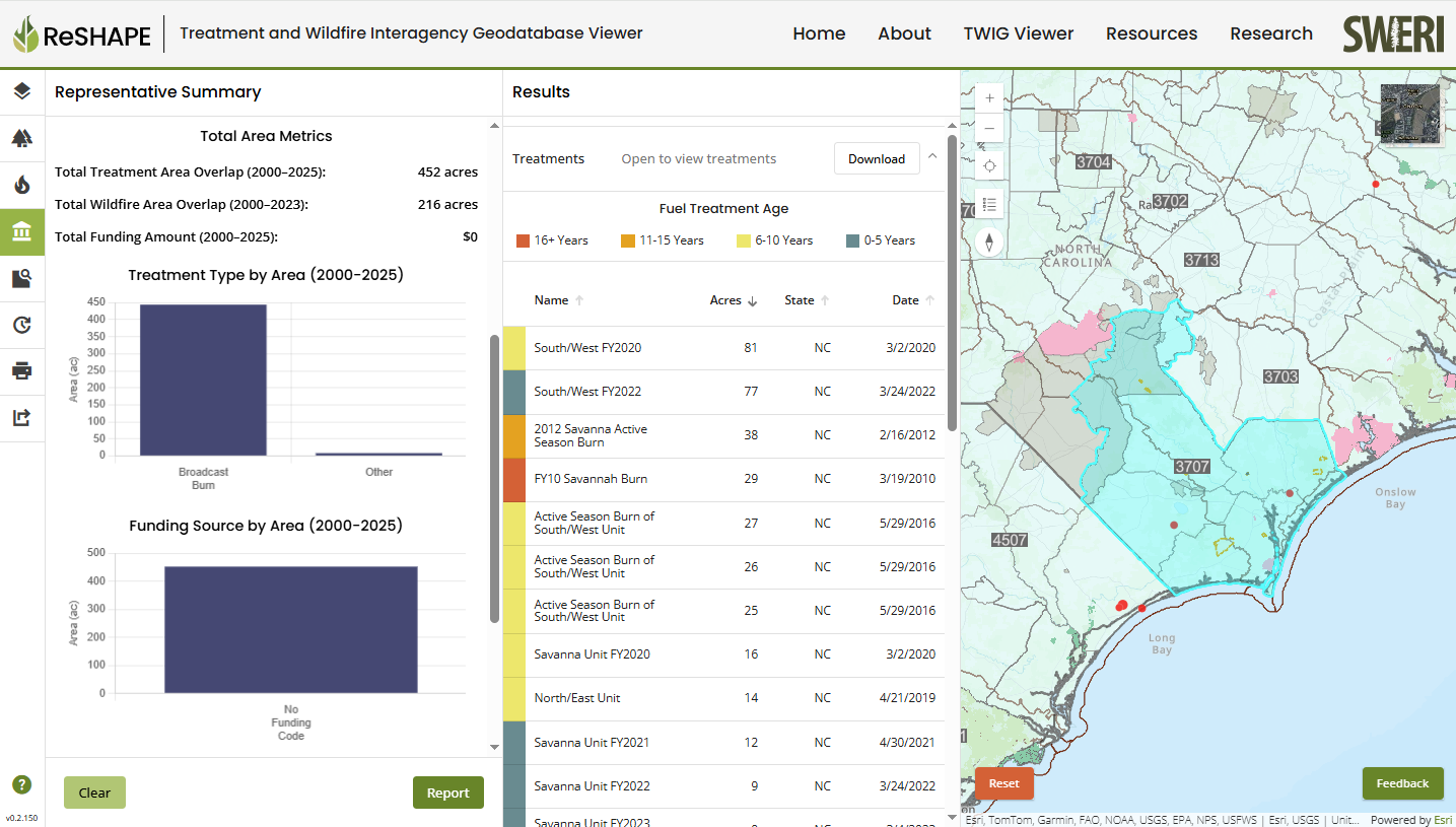
The Treatment and Wildfire Interagency Geodatabase (TWIG) Viewer is a custom application used to compile and display information on fuel treatment projects and wildfires at the national level. The Viewer is part of the SWERI's larger initiative, the ReSHAPE Program.

TWIG In Scientific Data

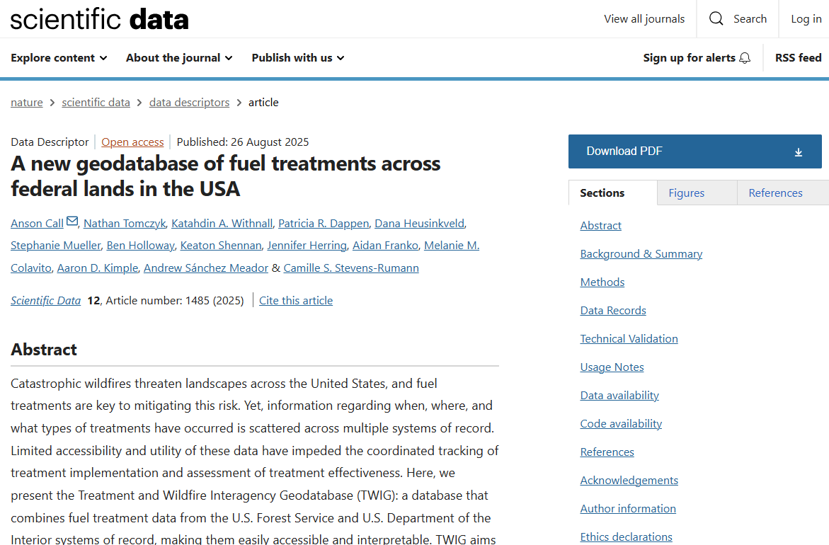
The SWERI team published its first journal article about the TWIG Viewer, "A new geodatabase of fuel treatments across federal lands in the USA ," in August 2025. The artile highlights the methods and logic used to compile wildfire treatment data, including limitations and suggested uses.

Talks

Esri User Conference 2017

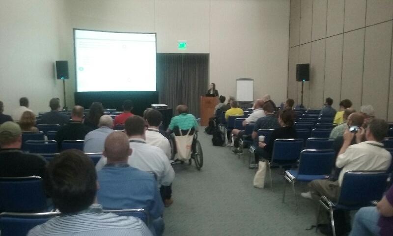
San Diego, CA
GeoEvents at EPA R9

EPA GIS Workshop 2018

Raleigh, NC
Geographic Response Plan (GRP) Tools and Widgets

EPA GIS Workshop 2023

Washington, DC
2023 Mason Hewitt Award Nominee, EPA Account Request Tool

EPA GIS Workshop 2024

Raleigh, NC
Water Emergency Team (WET) Tool